

100.6K
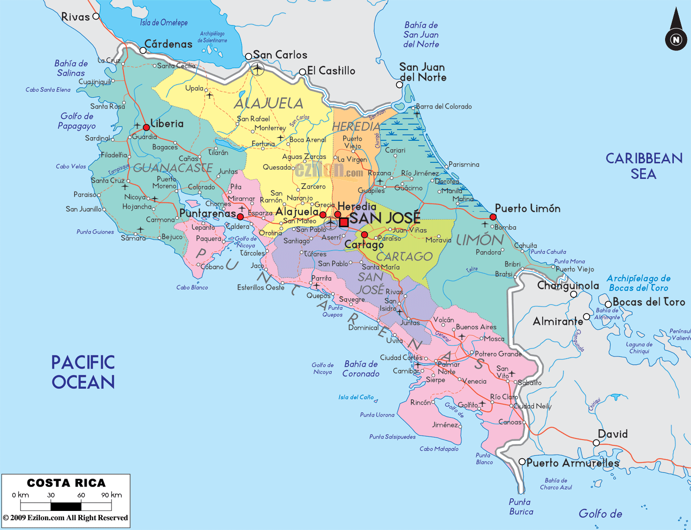
Costa Rica is divided into 7 Provinces which are :
 San Jose
Alajuela
Cartago
Heredia
Guanacaste
Puntarenas
Limon
Each of these provinces are in turn divided into Cantons which are in turn further divided into Districts. The links below are for the actual maps to each of the Cantons of Costa Rica. In those maps you will be able to see the make up of the different districts for all of the Provinces and Cantons of Costa Rica.
The maps are in a .pdf format and are provided by the University of Costa Rica based upon a project originally developed by the Costa Rican Institute of Municipal Consulting (IFAM).
To download the maps click on the links below.
Map of Costa Rica
Map of the Provinces and the Cantons of Costa Rica
Provincia de San José
- 101 San José
- 102 Escazú
- 103 Desamparados
- 104 Puriscal
- 105 Tarrazú
- 106 Aserrí
- 107 Mora
- 108 Goicoechea
- 109 Santa Ana
- 110 Alajuelita
- 111 Vásquez de Coronado
- 112 Acosta
- 113 Tibás
- 114 Moravia
- 115 Montes de Oca
- 116 Turrubares
- 117 Dota
- 118 Currridabat
- 119 Pérez Zeledón
- 120 León Cortés
Provincia de Alajuela
- 201 Alajuela
- 202 San Ramón
- 203 Grecia
- 204 San Mateo
- 205 Atenas
- 206 Naranjo
- 207 Palmares
- 208 Poás
- 209 Orotina
- 210 San Carlos
- 211 Alfaro Ruíz
- 212 Valverde Vega
- 213 Upala
- 214 Los Chiles
- 215 Guatuso
Provincia de Cartago
Provincia de Heredia
- 401 Heredia
- 402 Barva
- 403 Santo Domingo
- 404 Santa Bárbara
- 405 San Rafael
- 406 San Isidro
- 407 Belén
- 408 Flores
- 409 San Pablo
- 410 Sarapiquí
Provincia de Guanacaste
Provincia de Puntarenas
- 601 Puntarenas
- 602 Esparza
- 603 Buenos Aires
- 604 Montes de Oro
- 605 Osa
- 606 Aguirre
- 607 Golfito
- 608 Coto Brus
- 609 Parrita
- 610 Corredores
- 611 Garabito
Provincia de Limón


